Spatial Analysis

Spatial Analysis

Spatial Analysis

The collection of geographic data (Geomatics) and the organization of that data, Geographic Information Systems (GIS) is an integral part of understanding the natural environment and natural resource projects. If you are in the planning stages of a restoration or development project, we organize and provide existing GIS data to understand the historical context of an area. Using online GIS databases (e.g. dataBC), historical aerial photographs or old paper maps, we can help you understand how an ecosystem has come to its current state.

We improve upon existing datasets by collecting accurate and precise spatial data, tailored to the needs of each project. Using a variety of technologies including on the ground GNSS surveys, LiDAR, total station surveys, and drone mapping, we collect spatial data to show what the area looks like in the current moment.  We use these tools to survey & classify ecological features at a variety of spatial scales – anything from the path and morphology of a small stream, to land cover and vegetation communities in a large estuary, to physical and biological classification of an entire coastline. This allows us to provide you with up-to-date data describing the geography and biology of an area. From this data we can perform additional analysis, such as characterizing current habitat suitability and species distribution for a species of interest, creating models to estimate the impact of a development project, or modeling the potential impact of a natural disturbance such as sea level rise.

Data Collection

  • GNSS (GPS) positioning of features, environmental gradients
  • Drone orthoimagery collection to see a landscape aerial view
  • Total station surveys
  • Bathymetric and water column data with our SONAR, ADCP and ROV

Data Analysis and Visualization

  • Terrain mapping and modeling (3D models, hillshades, aspect, insolation)
  • Orthomosaics for up-to-date basemaps
  • Cartography and map presentation
  • Landscape change detection
  • As-built surveys of construction or restoration sites
  • Environmental impact footprint mapping

Reporting

  • Detailed report of project scope, rationale, actions and results
  • Topographic survey drawings
  • Spatial database
  • Aerial/underwater images for context

Freshwater Habitat Assessment and Mapping

Freshwater Habitat Assessment and Mapping

Freshwater Habitat Assessment and Mapping

Habitat assessments look at the state of the environment to understand what biological elements are using the habitat and how they may be potentially affected by a project. Since habitat availability is a limiting factor for many species, this is a vital component to risk managing the conflicts and constraints of a project.

As governmentally recognized Qualified Environmental Professionals (QEP), we can modify habitat assessments towards the collection of baseline data, impact assessments, natural resource inventories, climate change studies or post-construction effectiveness monitoring.

Recently, we have started engaging in the use of Environmental-DNA (eDNA) collection and analysis to provide evidence for the presence of rare or difficult to find species within an ecosystem. This tool and others help to build up a picture of how the habitat is performing and helps guide future management of the site.

Freshwater baseline and impact assessments

  • Critical habitat and sensitive species identification
  • Habitat and impact classification
  • Identifying compensation requirements and / or compliance with operational guidelines

Lakes, streams and wetlands

  • Fish surveys, enumeration and fish habitat assessments
  • Fish passage culvert assessments and stream classifications
  • Construction in-stream work isolation, fish salvage and channel restoration
  • Environmental Flow Needs

Riparian habitat assessments

  • Riparian Areas Regulation Assessments
  • Amphibian surveys and salvage
  • Riparian restoration plans and monitoring

Sampling

  • Environmental DNA (eDNA)
  • For fish aging, population studies
  • Water and sediment quality for baseline and impact analysis
  • Benthic and drift invertebrates for baseline and impact analysis
  • Vegetation for baseline, sensitive species identification

Accurate habitat imaging and mapping

  • Upland surveying and terrain modeling
  • Bathymetric profiling
  • Site surveying and GIS mapping using sonar, acoustic positioning, and dGPS
  • Underwater and aerial imaging and videography

Tools in our kit include

  • Snorkel and SCUBA surveys, drop cameras
  • Acoustic Doppler Current Profiler (ADCP)
  • Total Station, Rod and Level survey
  • Remotely Piloted Aerial Systems (RPAS or ‘drones’)

Eagle feeding on salmon at restored habitat

Bear standing in restored habitat feeding on salmon

Marine Habitat Assessment and Mapping

Marine Habitat Assessment and Mapping

Marine Habitat Assessment and Mapping

Habitat assessments look at the state of the environment to understand what biological elements are using the habitat and how they may be potentially affected by a project. Since habitat availability is a limiting factor for marine species, this is a vital component to risk managing the conflicts and constraints of a project. Our experienced multi-disciplinary team of WCB certified commercial SCUBA divers, biologists and technicians specializing in marine biology have the experience to identify habitat types, extents and sensitivity in a dynamic marine environment.

Marine subtidal, intertidal and estuarine ecosystems

  • Baseline and impact assessments
  • Critical habitat and sensitive species identification
  • Compensation requirements and / or compliance with operational guidelines
  • Habitat and impact classification
  • Example projects include log dumps, dock installations, boat ramps, industrial facilities

Organism Sampling And Identification

  • Surveys for important species such as abalone and eelgrass
  • Identify forage fish (sand lance, smelt and herring) spawning areas
  • ID the biodiversity of macroalgae, invertebrates and vertebrates
  • Eelgrass transplanting
  • Kelp propagation

Accurate Habitat Imaging And Mapping

  • Upland, foreshore surveying and terrain modeling
  • Intertidal and subtidal Bathymetric profiling
  • GIS mapping using sonar, acoustic positioning, and dGPS
  • Underwater and aerial imaging and videography

Tools In Our Kit Include:

  • Snorkel and SCUBA surveys, drop cameras
  • Remotely operated vehicle (ROV)
  • Remotely Piloted Aerial Systems (RPAS or ‘drones’)
  • Satellite imaging for historical context
  • SONAR surveys

We assist our clients in defining a project’s scope of impacts, identifying which habitat features are most likely to be impacted now or in to the future. We develop site-specific plans to mitigate or offset potential impacts followed by post-construction effectiveness monitoring. Should your project require compensation to offset unavoidable impacts, we offer years of experience in marine habitat restoration and habitat banking. We will manage each project efficiently and effectively within the constraints of time and budget.

Time-lapse of an estuarine vegetation inventory

Eelgrass survey from a drone flight over a marine lake

NCompas Media

NCompas Media

NCompas Media

NCompas Media is a media management solution that stores and organizes project related photographs, videos and documents. It generates professional and flexible reports that can be viewed, saved and downloaded as a PDF file.
NCompas Media is designed for commercial applications and complex, multi-phase projects that require detailed sorting and filtering capabilities for thousands of photos and documents. Database management is web based so that users can view and organize projects from a web browser anywhere they have an internet connection.

Key Features of NCompas Media:

  • Links field data with a specific project (photographs, videos and documents)
  • Efficient and secure method of storing, organizing and managing project media
  • Easy to implement within an organization and requires no re-arranging of current data structure.
  • Custom data fields associated with each photo – e.g. comments, coordinates, fish metrics and more

Collect

  • Collect photos using the Photo Station Monitoring App which can sync photos and data to the NCompas Media database and share across multiple users
  • Each photo can have custom comments, GPS coordinates, water discharge, fish metrics and more.
  • Upload most common digital files you want associated with a particular project
  • Search operators to find photos by key terms (e.g. project name, location) and send them to your mobile device
  • Photo Station Monitoring App auto-populates data fields for each photo as you upload

Manage

  • Secure and organize data by assigning user permissions to access
  • Organize and retrieve project information using detailed filtering options (e.g. phase, type, date, location…)
  • Easily produce annotated photo reports that can be drag and dropped into any order
  • Export CSV’s of photo metadata to quickly summarize for analysis (e.g. fish weights by site)
  • Records changes over time with different monitoring station types

Store

  • Data is stored on secure servers accessible via web or can be installed locally on client servers
  • Different levels of photo storage available including retention of RAW photos or other large files
  • Maintain linkage between photos and their associated data.

NCompas Photo Station Monitoring

NCompas Photo Station Monitoring

NCompas Photo Station Monitoring

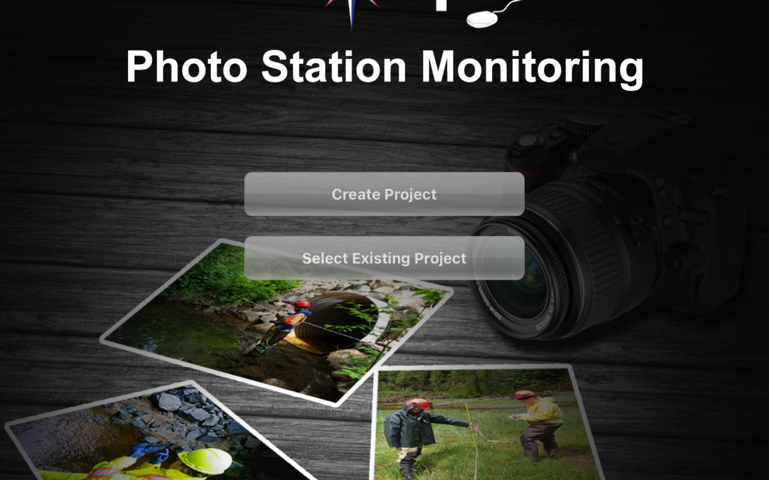
The NCompas Photo Station Monitoring (PSM) app was created to attach comments and key metadata to field photos as well as to make repeat photography easier. Photo station monitoring (also called photo point monitoring), is the process of documenting changes in an area of interest over time by taking repeat photographs from a static location and camera angle. In essence, creating a time-lapse of landscape change. The app’s ‘ghosting’ feature allows users to precisely replicate a reference photo, even if users are using different cameras.

For general field work, one of the most vital tasks is attaching comments to photos, indicating what the purpose of the photo is and why the photo is important for reference. The PSM allows the user to collect photos from a mobile device, associate specific data (e.g. comments, bearing, location) with each photo and then sync the collected photos and data directly into the NCompas Media database. The database than allows anyone with the PSM app to view and upload these photos to their own mobile device.

Key Features:

  • Ghosting allows users to replicate photos years apart
  • Associate and record 24 custom data fields with each photo
  • Examples include: Comments, GPS coordinates, water discharge, fish metrics and more.
  • Sync photos and data to the NCompas Media database and share across multiple users
  • Batch upload and organize multiple photos at a time
  • Save hours in the field by having drop down fields that fill in common information

Organism Sampling And Identification

  • Surveys for important species such as abalone and eelgrass
  • Identify forage fish (sand lance, smelt anherring ) spawning areas
  • ID the biodiversity of macroalgae, invertebrates and vertebrates
  • Eelgrass transplanting
  • Kelp propagation

The app is currently available for iOS and Android devices, Windows versions will be available soon. The app integrates completely with NCompas Media database and allows photos and data transmission via Wi-Fi or a cellular phone network.

For more information or to discuss specific project requirements, please contact us

NCompas Photo Station Monitoring App

Mapping

Mapping

Mapping

Maps are needed for all types of projects. Whether one must evaluate the health of an ecosystem, plan the construction of a trail network, determine changes over time in land use, or any number of other tasks, having a visual depiction is essential to achieving those goals. Beyond merely presenting data on a map, such information must also be conveyed in a manner that is easily coherent to the person receiving it. Thus, the key to creating any map can be summarized as three components: Understanding the client’s needs, organizing necessary data, and creating a deliverable that both fully and effectively communicates requirements set out by the project. Additionally, while it is common for the final product to be a digital static version, it is also possible to create georeferenced PDFs, infographics, and online interactive maps.

At M.C. Wright, we specialize in providing custom map products that are tailored to suit your project needs. Using Geographic Information Systems (GIS), a software designed to store and manipulate geographic data, we excel at taking details from a variety of sources and integrating it into a seamless output. Such sources may include remote vehicles such as satellites or drones that are capable of imaging in several wavelengths, fieldwork, and air photos. Furthermore, if information is not readily available, we also possess the means of acquiring appropriate data through our own resources, which includes drones, survey equipment, and fieldwork.

Marine Habitat Restoration

Marine Habitat Restoration

Marine Habitat Restoration

Habitat restoration is the process of returning a degraded habitat to a stable state that mimics its former pre-disturbed condition. Degradation can occur because of unnatural amounts of sediment, debris and solid structures, which often smother subtidal and intertidal marine life. This may create barren tracts of sea floor which lack 3-D habitat structure and points of attachment for kelp and algae. Or the bacteria which decompose submerged woody debris from log handling activities, reduces dissolved oxygen required for benthic and other aquatic organisms to thrive. Shoreline habitats can be impacted by the placement of artificial structures such as boat ramps, wharfs, or shoreline fills associated with coastal development projects

Habitat restoration is a stepping stone towards correcting imbalances from historical practices or cumulative impact of overdeveloped shorelines. By restoring habitat structure for intertidal salt marshes and sea grasses, high value marine habitat is produced that provides critical food sources and shelter to a variety of marine organisms. Habitat restoration stabilizes coastlines and marine sediments and acts as a valuable carbon sink in the fight against climate change.

Initial baseline surveys

  • Site identification and mapping
  • Species inventory and analysis
  • Water quality analysis

Restoration Prescription

  • Conceptual to detailed designs and reports
  • Artificial reefs, foreshore reclamation, sediment capping
  • Terrain modeling using SCUBA, ROV and sonar surveys
  • Sediment and drainage management plans
  • Regulatory agency approval processing

On-site project management

  • Biological salvaging
  • Riparian planting/thinning
  • Environmental monitoring and construction supervision

Reporting

  • Detailed report of project scope, rationale, actions and results
  • Topographic survey drawings
  • Spatial layers
  • Timelapse photography, videography
  • Aerial/underwater imaging
Restoration sites can also be developed to address habitat compensation requirements associated with proposed development in the marine environment. See Habitat Banking here

Habitat Restoration

Habitat Restoration

Freshwater Habitat Restoration

Habitat restoration is the process of returning a degraded habitat to a stable state that mimics its former pre-disturbed condition. Our restoration projects strive to mimic as closely as possible the functional condition of natural, undisturbed sites. Restoration sites can also be developed to address habitat compensation requirements associated with proposed development in the aquatic environment. See our habitat banking page for more info.

Habitat restoration is a stepping stone towards correcting imbalances from historical practices or cumulative impact of overdeveloped watersheds. By restoring habitat structure for aquatic species, cover and stable habitat is provided for invertebrates and other critical food sources for species such as juvenile salmonids which have high cultural and environmental value. Habitat restoration helps create a dynamic stability of stream banks, allowing vegetation to rapidly grow and acts as a valuable carbon sink in the fight against climate change.

Initial baseline surveys

  • Site identification
  • Water quality
  • Species inventory
Bear feeding in restoration project area

Restoration Prescription

  • Conceptual to detailed designs and reports
  • Groundwater and side channels, alcove ponds, groynes
  • GIS mapping and terrain modeling
  • Sediment and drainage management plans
  • Sediment catchment basins
  • Regulatory agency approval processing

On-site project management

  • Biological salvaging
  • Riparian planting/thinning
  • Environmental monitoring and construction supervision

Tools In Our Kit Include:

  • Snorkel and SCUBA surveys, drop cameras
  • Total station surveys
  • Remotely Piloted Aerial Systems (RPAS or ‘drones’)
  • Satellite imaging for historical context

Artlish Habitat Restoration

Salmon migrating up recently restored habitat

Freshwater stock assessment

Freshwater stock assessment

Freshwater Stock Assessment

Stock assessment is the process of collecting and analyzing information on the population of a particular fishery species. This data is used to predict the effects of harvest, as well as predicting how future catches and changes in regulation may affect the population into the future. In order to sustainably manage fish populations for future generations, fishery managers need a variety of well collected data.
We have extensive experience collecting, analyzing and reporting juvenile and adult fish demographics using a variety of data collection methods. From visual estimates such as snorkel surveys, to implementing fish counting fences and mark recapture studies, we adapt our methods to suit the budget and needs of a particular program.

Because fish, salmon in particular, are integral to First Nations cultures of British Columbia, we strive to work with local indigenous communities to receive traditional knowledge, and offer capacity building opportunities for Nations developing their fisheries management programs. See our First Nations partnerships page for more info

Population Estimation

  • Snorkel Area Under the Curve (AUC), foot, aerial, and SCUBA surveys
  • Electrofishing, pole and beach seining, fence traps
  • Telemetry, electronic counters
  • Coded wire tagging
  • Peterson mark and recapture

Long term monitoring development and infrastructure

  • Habitat suitability assessments
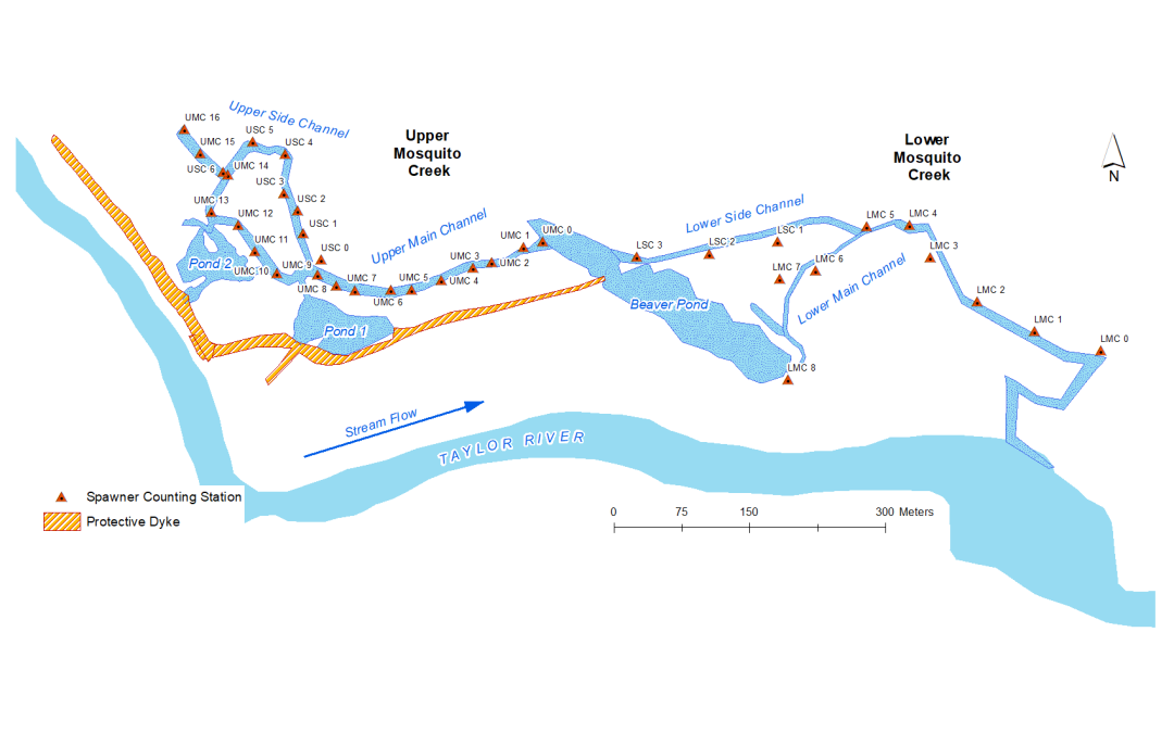
  • Installation of counting stations on streams, rivers and lakes
  • Biosampling

Sockeye Salmon in the Burman River

Envirocheck

Envirocheck

Envirocheck

Envirocheck is a customizable mobile data collection app that replaces the need for field notes and paper forms. Field time is limited, data needs to be collected efficiently and consistently so that costs are kept low while assuring that all the required data is collected. After data collection, the app can automatically create and transmit a PDF inspection report with full colour annotated photographs directly from the field via internet or other wireless data transmission.

EnviroCheck is customizable in the user’s choice of fields to include, when to have drop down menus for selecting common data (e.g. species) and can be set so that important mandatory fields cannot be left blank before transmitting the report. By using a digital field data collection form, you can incorporate the digital metadata associated with photos (e.g. gps coordinates, time) as well as attach comments to any photo.

Key Features of EnviroCheck:

  • Eliminate in-office data transcription and wait times
  • Entire report can be compiled and sent from a mobile device
  • Field photos are managed and stored within the report.
  • Auto-report generation options that can instantly produce a final PDF report with photos and sends a copy via e-mail to your listed recipients.
  • EStores archived reports for future retrieval

EnviroCheck can be used in any industry or application that uses a standard set of inspection or survey parameters to collect data. It eliminates the need to transcribe field notes and write reports back in the office, the entire report can be compiled and sent from a mobile device.

Example Applications

  • Environmental Construction Monitoring – e.g. culvert replacement
  • Pollution & Prevention Control Inspections– specifically designed to meet requirements for LEED™ SS prerequisite 1
  • Biological Surveys
  • Condition and Compliance Inspections (engineering, forestry, regulatory etc.)
  • Kelp propagation

EnviroCheck was developed as a joint venture with Aqua-Tex Scientific Consulting Ltd.